Monitoring potential tropical system currently in the Gulf
A low-pressure system will cross the Florida peninsula and could strengthen off the Georgia coast. A low-pressure system in the Gulf of Mexico is expected to cross the Florida peninsula and could strengthen off the Georgia coast. The National Hurricane Center is giving a 10-20% chance of forming a tropical depression or tropical storm over the next two to seven days. The system is moving northeastward across Florida before moving offshore near the Georgia and South Carolina coast by late Wednesday. The main threats will be for flooding rain over parts of south Florida, where some areas have already received 3-10 inches of rain. However, this system will not generate significant rainfall or wind, but could potentially strengthen.
Opublikowany : 2 lata temu za pomocą Author: Chris Holcomb w Weather
A low-pressure system will cross the Florida peninsula and could strengthen off the Georgia coast.
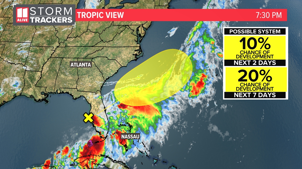
ATLANTA — The 11Alive StormTrackers are closely watching an area of low pressure in the Gulf of Mexico as it spreads flooding rain over parts of the Florida peninsula. The National Hurricane Center is giving this system a 10-20% chance of forming a tropical depression or tropical storm over the next two to seven days.
As of 8 p.m. Tuesday, this elongated area of low pressure is near the west central coast of Florida. It will move northeastward across Florida tonight and move offshore near the Georgia and South Carolina coast by late Wednesday. Slow development is possible with this system once it moves over into the Atlantic.
Right now, the main threats will be for flooding rain possible over parts of south Florida. Some areas have already picked up 3-10 inches of rain. More rain is on the way for them.
Here's the setup. There is a stalled out front in northern Florida. The tropical moisture is mainly south of that front. We are on the side of the front that is dealing with building heat.
Take a look at the spaghetti model plots, and you can see the projected track of this system. It would cross Florida and emerge in the Atlantic east of the Georgia and South Carolina coasts. The models show the system staying offshore in the Atlantic and moving northeast just off of the coast through Saturday evening.
Since this system stays well to the east of the metro area, we won't get any rain or wind from it. The Georgia coast could see a few showers from it and maybe some rough surf.
Hurricane season started on June 1. Activity usually starts ramping up during the summer, with a peak in the season on September 10. The season ends November 30.